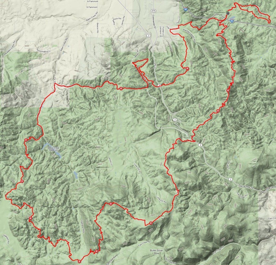
Butte 50 Course Details
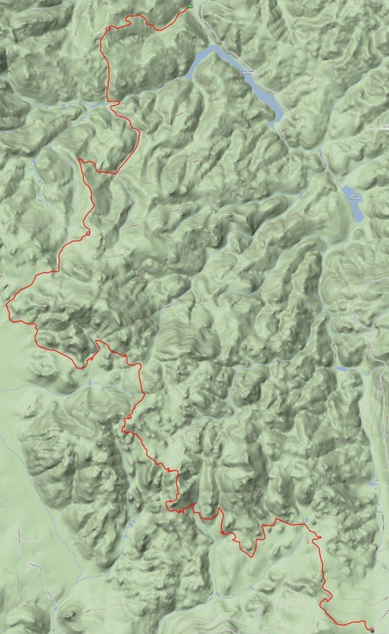
The 50 mile version of the Butte 100 is a crowd favorite with epic amounts of single track on the Continental Divide Trail, sweeping views of the Highland mountains, and athletic tests such as the notorious Basin Creek climb. Racers will encounter dense wooded areas with buff packed dirt progressing to loose decomposed granite surfaces. The 50 mile course is sometimes referred to as the “South Loop” because the 100-milers begin their race on the heading to the north portion of the course, before chasing down the 50-milers on the South Loop.
View interactive course map and elevation profile
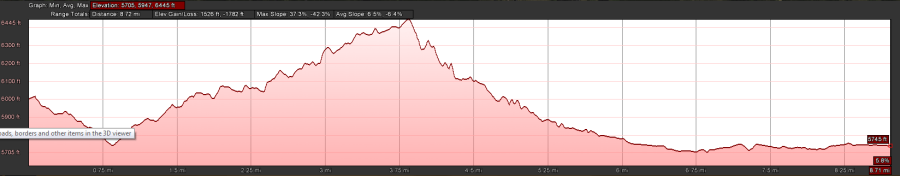
50 Mile Course at a glance
52.4 total miles
8,500 ft. elevation gain
4 Total Aid Stations- Numbered #1-4
More detailed course descriptions will be included in the Race Bible
50-Mile Course
(Click on any maps or elevation profiles to enlarge)
Starting loop
4.8 miles; 551 ft. elevation gain; 4.8 mi. cumulative
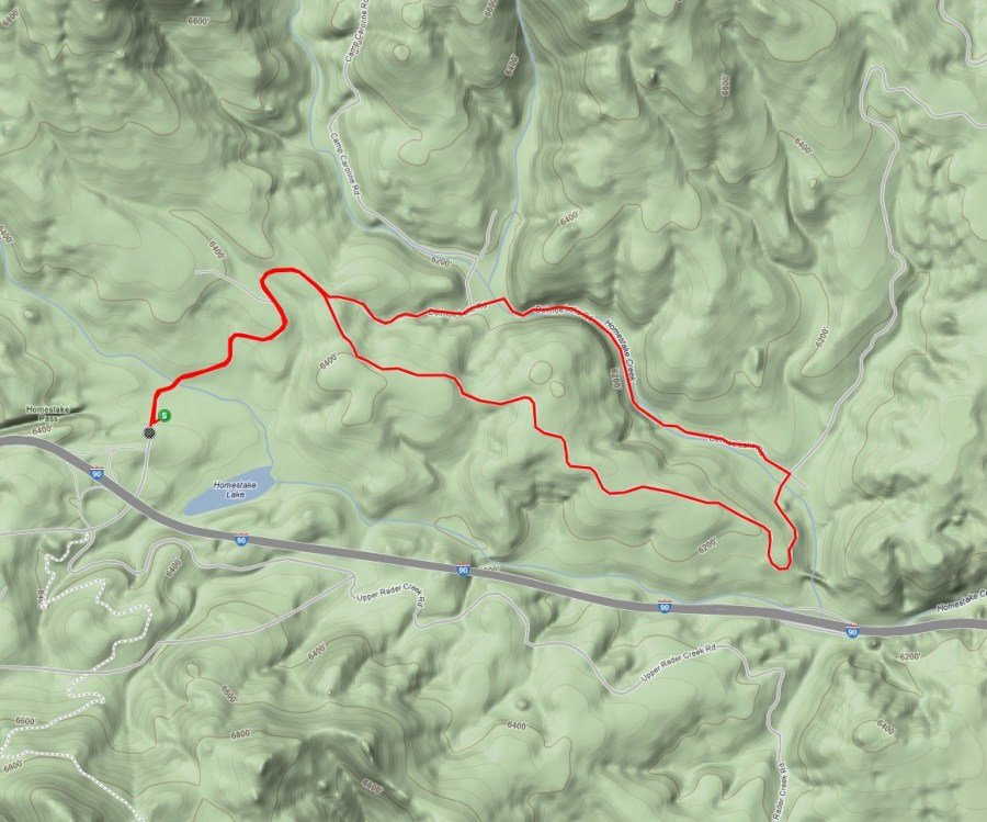
Start loop on sandy double track meant to spread racers out for safety reasons
Start area to Aid Station #1 (Thompson Park)
8 miles; 1,563 ft. elevation gain; 12.8 mi. cumulative
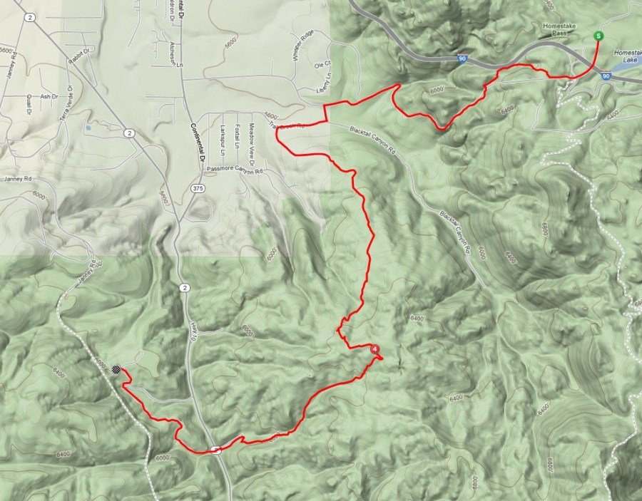
Racers will pass by the starting area. This is not meant to be an aid station (#6) but can if problems exist
Black Tail descent immediately follows start loop; single and double track, quite technical,with a bottle neck
Short ride on an asphalt connection, through a housing division to Black Tail Trailhead; 3 mi. climb and 3 mile descent to Hwy 2 crossing and Thompson Park area
Aid Station #1 to #2 (Basin Creek)
8.7 miles; +1,192ft.; 21.5 mi. cumulative
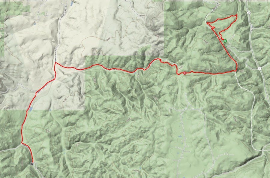
Climb to “The Chimney” on singletrack and some RR bed
Descent on dry singletrack (watch for wash-outs)graduating to dual track, established double track, then gravel road into Basin Creek Aid station #8
Aid Station #2 to #3 (Highlands)
12.5 miles; +2,593 ft.; 34 mi. cumulative
The Basin Creek climb consists of a very dry double track
4 mile climb to CDT left turn (King/Queen of the Mountain checkpoint) 2-mile climb remaining on buff single track
Beautiful single track to Highlands aid station #9
Aid Station #3 to #4 (Highway 2)
11.5 miles; +1,266 ft. elevation gain; 45.5 mi. cumulative

“8 Miles of Hell” right out of aid station along CDT buffed/slight dry single track
Continue on CDT through the Limekiln intersection (a beautiful portion of course)
Nice downhill to Aid Station #10 at Hwy 2
Note: a USA Cycling official will be enforcing racer cut-offs at Hwy 2 aid station #10. Those pulling in after 7:00 p.m. will not be allowed to continue, no exceptions.
Aid Station #4 to Finish
9.1 miles; +1,344 ft.; 54.6 mi. cumulative
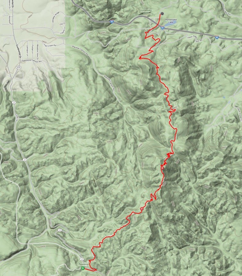

Final significant climb (after Beaver Ponds trail junct.) Stay on CDT
Buff single track through boulders and woods
Descent to I-90 intersection-should start hearing car noise
Right turn on concrete, over the overpass and into the finish line